Hurricane Melissa Poised for Major Strike in Jamaica, Haiti and the Dominican Republic
The storm now officially named Hurricane Melissa has undergone a striking transformation, evolving rapidly into a major threat for Caribbean nations, notably the island of Jamaica and parts of Hispaniola.
Rapid intensification and slow motion
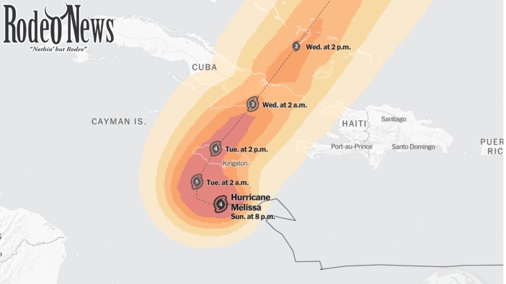
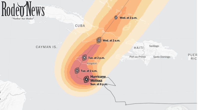
Meteorological agencies report that Melissa has achieved Category 4 status on the Saffir-Simpson scale, and is forecast to potentially reach Category 5 strength before landfall.
One particularly dangerous characteristic: the storm is moving remarkably slowly — at times less than a walking pace. That sluggish pace greatly raises the risk of prolonged heavy rainfall and flooding.
Forecast track and affected regions
The core of the storm is expected to approach or make landfall in Jamaica late Monday into early Tuesday, before moving toward eastern Cuba and possibly the Bahamas afterward.
Jamaica is under a hurricane warning; parts of southwestern Haiti and eastern Cuba are on alert for hurricane conditions.
Dangerous rainfall, landslides and storm surge
In Jamaica and southern Hispaniola, rainfall totals of 15 to 30 inches are anticipated, with isolated regions possibly exceeding 40 inches.
The slow pace means rainfall may linger, increasing flood- and landslide-risk.
Storm surge on Jamaica’s southern coast could reach 9 to 13 feet, with large destructive waves expected.
Infrastructure damage, extended power/communication outages and isolation of communities are being warned.
Already mounting human cost
Fatalities have already been reported: at least three people in Haiti and one in the Dominican Republic have died due to flooding and landslides before the storm’s worst phase.
Many shelters have been activated and evacuations ordered in vulnerable areas.
Why this storm is especially perilous
Several factors make this storm more than just another hurricane:
Rapid intensification: Melissa increased wind strength at a pace exceeding typical intensification thresholds, capitalising on very warm Caribbean waters and favourable conditions.
Slow movement: A slow-moving system lingers over the same regions, dumping large amounts of rain and compounding flooding/landslide risk.
Live Science
Terrain risk: Jamaica, Haiti and the Dominican Republic all have mountainous terrain and flood‐prone zones, which heightens landslide danger when heavy rain builds over time.
Vulnerable infrastructure: Many of the affected communities have limited resources to withstand multi-day storms, protracted outages and extreme rainfall.
What residents and authorities should prioritise
Move immediately to safe shelter if under a hurricane warning or in low-lying or landslide-prone areas.
Secure property now: strong winds, collapsing trees, flying debris and storm surge are imminent threats.
Plan for prolonged interruption of services: power, water and communications may be down for days.
Stay informed: track updates from the National Hurricane Center and local meteorological services.
Avoid false hopes of “just a strong wind” event — the larger danger here is sustained rainfall, flooding and landslides.
Final word
Hurricane Melissa is shaping up to be one of the more serious threats of the 2025 Atlantic hurricane season. Its combination of rapid intensification, slow movement and the vulnerable geography of Jamaica, Haiti and the Dominican Republic raises the stakes significantly. Communities in these areas must treat this as a major emergency and act accordingly