
Severe Storms Minnesota: Shocking Tornado, Giant Hail Strike Hard
Severe storms Minnesota residents experienced on April 13, 2026, turned dangerous as powerful weather systems unleashed tornadoes and massive hail across the southern part of the state. The intense outbreak brought widespread disruption, raising concerns among meteorologists and emergency officials as spring storm season intensifies across the Midwest.
The violent weather event developed rapidly during the afternoon and evening hours, fueled by warm temperatures, atmospheric instability, and a strong frontal boundary moving through the region. As a result, communities across southern Minnesota faced a combination of destructive hail, damaging winds, and confirmed tornado activity.
Tornadoes Confirmed Across Southern Minnesota
Meteorologists confirmed multiple tornadoes touched down during the severe storms Minnesota event, marking one of the most significant weather days of the season so far.
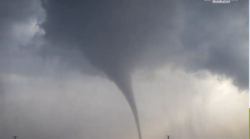
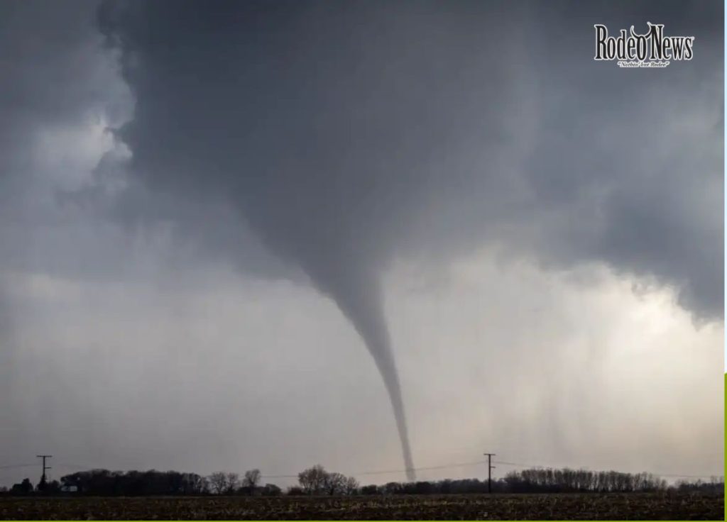
According to reports from the National Weather Service, at least three tornadoes were identified across southern Minnesota. One of the most notable sightings occurred near Amboy in Blue Earth County, where a rotating supercell produced a visible funnel cloud that moved across rural farmland.
Storm chasers and residents captured dramatic images and videos showing the tornado carving a path through open fields. While initial reports suggested limited structural damage, officials continue to assess the full impact, especially in rural areas where infrastructure is more vulnerable.
Tornadoes during early spring are not uncommon in the Midwest, but the intensity and timing of this system highlight how quickly conditions can escalate when atmospheric ingredients align.
Baseball-Sized Hail Causes Widespread Damage
One of the most alarming aspects of the severe storms Minnesota residents faced was the size of the hail. In several locations, hailstones reportedly reached the size of baseballs, posing serious risks to people, vehicles, and property.
Photos from areas such as Faribault and Northfield showed large chunks of ice scattered across roads and yards, with some pieces exceeding two inches in diameter.
Meteorologists had warned earlier in the day that conditions were favorable for “very large hail,” with strong updrafts inside thunderstorms capable of suspending ice particles long enough for them to grow significantly.
This type of hail can shatter windows, dent vehicles, and damage crops, making it one of the most destructive elements of severe weather events.
Dangerous Driving Conditions Reported
As the storms intensified, authorities warned drivers about extremely hazardous conditions. Heavy rain, reduced visibility, and large hail created dangerous travel situations across highways and rural roads.
The combination of slick surfaces and sudden impacts from falling hailstones made driving particularly risky. In some areas, motorists were forced to pull over to avoid damage or accidents.
Weather experts emphasize that during severe storms Minnesota drivers should avoid travel whenever possible, especially when hail or tornado warnings are issued.
Meteorological Setup Behind the Storms
The severe storms Minnesota experienced were the result of a classic springtime weather setup in the Upper Midwest.
Warm, moist air surged northward into the region, pushing temperatures into the 70s across southern Minnesota. At the same time, a cooler air mass remained in place to the north, creating a sharp contrast that helped fuel storm development.
A frontal boundary acted as a trigger, allowing thunderstorms to rapidly intensify during the late afternoon. These storms evolved into supercells—highly organized systems capable of producing tornadoes, large hail, and damaging winds.
Meteorologists also noted that wind shear, a key ingredient for tornado formation, was present at significant levels, increasing the likelihood of rotating storms.
Timeline of the Severe Weather Event
The progression of the severe storms Minnesota outbreak followed a clear timeline:
- Afternoon (4–6 PM): Initial storm development began in south-central Minnesota.
- Early Evening: Storms intensified, producing large hail and strong winds.
- Evening (around 6:30 PM): Tornado activity was confirmed near Amboy.
- Late Night: Storms continued moving east into Wisconsin, gradually weakening.
This pattern is typical of severe weather systems that track from west to east across the Midwest, often affecting multiple states in a single event.
Broader Midwest Severe Weather Threat
The severe storms Minnesota faced were part of a larger system impacting the Upper Midwest and beyond. Similar conditions were reported in neighboring states, including Wisconsin, Michigan, and parts of Illinois.
Meteorologists warned that this outbreak could be the beginning of a multi-day severe weather pattern affecting tens of millions of people across the central United States.
Such widespread systems are common during the spring season, when temperature contrasts and atmospheric dynamics create ideal conditions for severe storms.
Why Spring Storms Are So Dangerous
Spring is historically one of the most active periods for severe weather in the United States, particularly in regions like Minnesota.
Thunderstorms during this time are fueled by high humidity and strong temperature gradients. When combined with jet stream dynamics, these factors can produce powerful storms capable of generating tornadoes and large hail.
According to climatological data, Minnesota regularly experiences severe thunderstorms between March and November, with peak activity occurring in late spring and early summer.
However, early-season storms like this one can catch people off guard, especially after months of relatively calm winter weather.
Safety Tips During Severe Storms
As severe storms Minnesota continues to experience highlight the risks of extreme weather, experts recommend several key safety precautions:
1. Stay Informed
Monitor weather alerts through reliable sources such as the National Weather Service.
2. Seek Shelter Immediately
If a tornado warning is issued, move to a basement or interior room away from windows.
3. Avoid Driving
Large hail and strong winds can make roads extremely dangerous.
4. Protect Property
Park vehicles in covered areas and secure outdoor objects.
5. Prepare Emergency Kits
Include essentials such as water, flashlights, and first aid supplies.
Taking these steps can significantly reduce the risk of injury during severe weather events.
Damage Assessment and Recovery Efforts
In the aftermath of the severe storms Minnesota endured, local authorities began assessing damage across affected areas.
While early reports indicate that much of the damage was limited to rural regions, officials are still evaluating the full extent of the impact. Power outages, damaged vehicles, and agricultural losses are among the primary concerns.
Emergency crews remain on standby to respond to any additional incidents, while residents are urged to report damage and stay cautious during cleanup efforts.
What Comes Next for Minnesota Weather
Following the storm system, conditions are expected to stabilize temporarily, with cooler temperatures and lighter winds returning to the region.
However, meteorologists warn that the broader weather pattern remains active, meaning additional severe storms could develop in the coming days.
Residents are advised to remain vigilant as the spring storm season progresses, especially during periods of rapid temperature changes and high humidity.
Conclusion: A Powerful Reminder of Nature’s Force
The severe storms Minnesota experienced serve as a stark reminder of the power and unpredictability of nature. From tornadoes touching down in rural communities to baseball-sized hail damaging property, the event underscores the importance of preparedness and awareness.
As climate patterns continue to influence weather behavior, events like this may become more frequent or intense. Staying informed and ready is essential for minimizing risk and ensuring safety.
For now, Minnesota begins the process of recovery—while keeping a close eye on the skies.