
September Nor’easter: 5 Big East Coast Threats Ahead
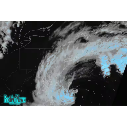
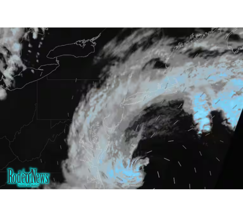
A powerful September nor’easter is strengthening along the U.S. East Coast, with heavy rain, strong winds, coastal flooding and dangerous surf expected to affect communities from the Mid-Atlantic through New England. The storm is forecast to become most disruptive from late Friday into the weekend, when wind gusts could reach 40 to 60 mph and rainfall could become heavy enough to cause localized flooding.
The unusual early-season storm is drawing attention because of its combination of prolonged winds, coastal inundation and large waves. The Washington Post reported that the system could linger offshore from the Mid-Atlantic toward the Long Island area, with the heaviest impacts concentrated along portions of the Northeast coast. Some locations could receive as much as 6 inches of rain.
The National Weather Service is also warning of a prolonged period of strong to damaging winds, coastal flooding, beach erosion and periods of heavy rain across parts of New England. Power outages are another concern, particularly along the coast where trees remain fully leafed.
Here are five major threats residents and travelers should watch as the September nor’easter develops.
1. September nor’easter could bring 60 mph wind gusts
Strong winds are expected to become one of the most significant hazards as the storm intensifies.
Forecasts indicate that exposed coastal locations could see gusts between 40 and 60 mph, particularly from New Jersey northward into New England. The strongest winds are expected near the coastline, where the storm’s circulation can produce persistent northeast winds over the ocean and coastal communities.
The National Weather Service’s Boston office issued a High Wind Warning for parts of the area and warned that damaging gusts could persist into the weekend. A Wind Advisory was also issued for some locations farther inland.
These winds can create several problems.
Trees and branches may come down, especially where the ground becomes saturated by rain. That can increase the risk of power outages. Loose outdoor objects can also become dangerous if they are picked up by strong gusts.
Drivers should be particularly cautious on bridges, elevated roads and exposed coastal highways. High-profile vehicles can be vulnerable to sudden crosswinds, while fallen branches and debris can create additional hazards.
2. Heavy rain may trigger localized flooding
Rainfall is another major concern.
The storm is expected to produce periods of moderate to heavy rain from the Mid-Atlantic into New England. Because the system is forecast to move relatively slowly, some areas could experience repeated rounds of precipitation rather than a quick burst of rain.
The Washington Post reported that the wettest locations could receive up to about half a foot of rain.
That amount will not fall uniformly across the region. The exact rainfall totals will depend heavily on the storm’s track and how long individual communities remain under the heaviest bands.
Urban areas can be particularly vulnerable because pavement prevents water from quickly soaking into the ground. Poor drainage can lead to standing water on streets, while already saturated areas may experience additional runoff.
Travelers should therefore monitor local forecasts rather than relying solely on a single regional rainfall estimate.
A storm that produces manageable rainfall in one location can create significant flooding just a short distance away if its heaviest rain bands stall over the same area.
3. Coastal flooding and beach erosion could become serious
For many coastal communities, flooding may be an even greater concern than rainfall.
A strong northeast wind blowing toward the shoreline can push ocean water inland. When that happens during high tide, water levels can rise rapidly in vulnerable coastal neighborhoods.
The National Weather Service has highlighted the potential for coastal flooding and beach erosion during the storm. In the Mid-Atlantic, forecasters have warned that some locations could experience moderate to locally major tidal flooding depending on the storm’s position and wind direction.
Washington, D.C., has already experienced coastal flooding concerns along parts of its shoreline, demonstrating how far inland the effects of elevated tides can reach in tidal waterways.
Farther north, Boston and surrounding coastal areas are facing an extended period of coastal hazards. The National Weather Service has posted coastal flood and high-surf hazards for the region through the weekend.
Beach erosion is another threat.
Large waves repeatedly striking the shoreline can remove sand and damage dunes. Roads, boardwalks, parking areas and other infrastructure close to the water may be exposed to waves and rising water.
Residents in low-lying coastal locations should take official evacuation or flood instructions seriously and avoid driving through flooded roads.
4. Dangerous waves and high surf will affect the coast
The September nor’easter is also expected to produce dangerous marine conditions.
Strong winds over the Atlantic can generate large waves that travel toward the coast. Even locations that avoid the strongest rainfall may still experience hazardous surf and powerful rip currents.
The Washington Post previously estimated that parts of the coast could see waves reaching roughly 10 to 15 feet, while other reports have highlighted even higher waves in exposed waters.
These conditions are particularly dangerous for swimmers, surfers, boaters and people visiting beaches to watch the storm.
A calm-looking beach can become dangerous very quickly when wave sets increase. Large waves can also sweep people from rocks, jetties and seawalls.
For boat operators, the combination of strong winds, high waves and reduced visibility can create extremely difficult conditions.
The National Weather Service has warned of storm conditions over offshore waters, reinforcing the danger to marine traffic.
People should stay away from exposed rocks and waterfront structures when conditions deteriorate. Watching the waves from a safe location is far safer than approaching the water.
5. New England faces the storm’s strongest weekend impacts
New England is expected to become one of the main areas of concern as the storm moves north.
The biggest impacts are forecast from late Friday through Sunday, with coastal Massachusetts, Rhode Island, Connecticut and parts of Maine among the areas that could experience strong winds, heavy rain, flooding and high surf.
Boston is already under significant weather alerts. The National Weather Service has issued a High Wind Warning, Coastal Flood Watch and High Surf Advisory covering portions of the area as the storm approaches.
The prolonged nature of the storm is especially important.
Instead of producing several hours of bad weather and quickly moving away, the system could remain influential for much of the weekend. That means multiple high-tide cycles could occur while strong winds and large waves continue.
This increases the potential for repeated coastal flooding.
It also means residents should not assume that conditions will improve simply because the rain temporarily becomes lighter. Wind and coastal hazards can remain dangerous even during breaks in precipitation.
Why this September nor’easter is unusual
Nor’easters are common along the East Coast during the colder months, particularly from late fall through winter and into early spring.
A powerful storm arriving in September is less typical.
The timing matters because temperatures remain relatively mild, ocean waters are still warm and vegetation is still fully developed. That can influence the storm’s impacts in several ways.
Fully leafed trees can provide more resistance to strong winds, increasing the chance that branches or entire trees could come down. Saturated soil from prolonged rainfall can make trees more vulnerable to falling.
Meanwhile, warm ocean water can provide energy for a developing coastal storm.
The result is a weather system that may resemble some of the more familiar Northeast coastal storms in terms of wind, waves and flooding, even though it is arriving earlier in the year.
The storm track remains important
One of the biggest uncertainties with any coastal storm is its exact track.
A storm passing farther offshore can still produce strong winds and dangerous surf, but it may limit the worst inland rainfall and wind impacts.
A track closer to the coast can have the opposite effect.
Recent forecasts have increasingly focused attention on the possibility of a storm track close enough to the coastline to increase wind and flooding risks. Meteorologists have emphasized that relatively small changes in the storm’s position can significantly alter local conditions.
That is why residents should continue checking updated forecasts.
Weather models become more useful as the storm gets closer, but local impacts can still vary substantially over short distances.
For example, one coastal community may experience major flooding while another nearby location sees only minor flooding because of differences in shoreline orientation, elevation and local tidal conditions.
What residents should do before the storm peaks
People living in areas vulnerable to flooding or high winds should prepare before the worst weather arrives.
Outdoor furniture, decorations, trash containers and other loose objects should be secured or moved indoors.
Residents should charge phones and other essential devices in case of a power outage. Flashlights, batteries, drinking water and basic emergency supplies should also be readily available.
People who live in flood-prone areas should move valuable items to higher locations where possible.
Drivers should avoid flooded roads and never attempt to cross water when the depth or current is uncertain.
Coastal residents should also stay away from beaches, jetties and exposed waterfront structures once dangerous surf develops.
Most importantly, residents should follow local emergency-management instructions. Conditions can change quickly when a coastal storm intensifies.
Weekend travel could face disruptions
The storm could also create problems for transportation.
Heavy rain can reduce visibility and create standing water on roads. Strong crosswinds can affect vehicles on bridges and elevated highways. Flooding can close low-lying roads, while fallen trees and power lines can create additional obstacles.
Air travelers could also encounter delays if strong winds, thunderstorms or heavy rain affect airports across the Northeast.
Marine travel is likely to face even greater challenges because of high waves and strong winds.
Anyone traveling along the East Coast this weekend should check the latest forecast shortly before departure and be prepared to change plans if conditions deteriorate.
The biggest concern is the combination of hazards
The September nor’easter is dangerous not because of one single weather threat, but because several hazards are arriving at the same time.
Strong winds can cause power outages.
Heavy rain can create flooding.
High tides can push ocean water farther inland.
Large waves can damage beaches and coastal infrastructure.
And when these hazards overlap, their effects can become more severe.
For example, heavy rain may saturate the ground while strong winds increase the risk of falling trees. At the same time, coastal flooding can block drainage systems and make it harder for rainwater to escape.
This combination makes the storm especially important for communities along the Northeast coast.
What happens next
The storm is expected to remain a major weather story through the weekend as it tracks northward and gradually evolves offshore.
The exact intensity and location of the strongest impacts will continue to depend on the storm’s path.
For now, the clearest message from forecasters is that coastal communities from the Mid-Atlantic through New England should remain alert.
The National Weather Service is already warning of a strong and long-duration coastal storm, including damaging wind gusts, coastal flooding, beach erosion and periods of heavy rain.
The storm may eventually weaken and move away, but the coastal effects could continue after the center of the system has passed.
For residents, the best approach is preparation rather than panic: secure outdoor objects, protect flood-prone property, avoid dangerous shorelines and monitor official warnings.
The early arrival of this September nor’easter is a reminder that significant East Coast storms do not always wait for winter. This weekend, a combination of wind, rain, waves and rising coastal water could create difficult conditions across one of the most densely populated parts of the United States.